Cooley Brook
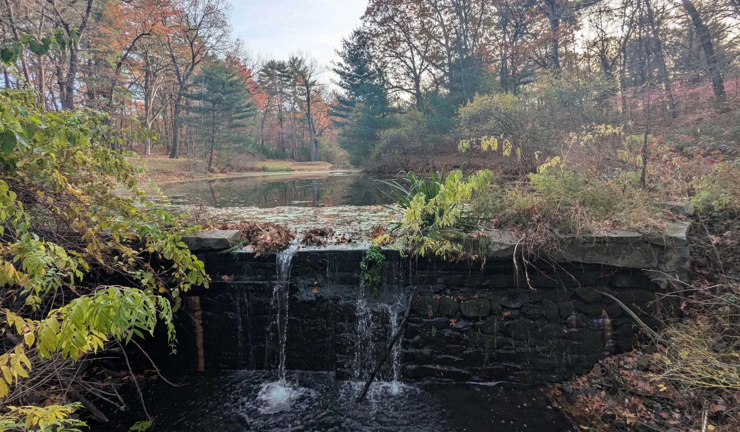
A dam on Cooly Brook in Laurel Park (Photo taken in 2025)
In the late 1800s, the growing population of Longmeadow, Massachusetts, needed a new source of drinking water. In response, the town's government established a Water Commission and chose to utilize Cooley Brook as a drinking water supply.
That initiative included the creation of a dam on Cooley Brook, which created a reservoir to serve the town's residents. A few years later, in 1906, the town purchased the land now known as Bliss Park and Laurel Park through eminent domain to protect the water quality within the reservoir.
Despite those efforts, the reservoir remained in use as a drinking water supply for only a short time as Longmeadow voted to join Springfield's water system in 1924. Following that decision, the residents of Longmeadow used the reservoir as a popular swimming hole. That use diminished following the creation of a more formal pool at Bliss Park in the 1950s.
Today, Cooley Brook maintains a similar shape, running less than two miles through Longmeadow before emptying into the Connecticut River.
The portion of the brook in Laurel Park continues to hold a considerable amount of abandoned infrastructure related to the brook's former use as a reservoir. For example, the brook houses several concrete walls, multiple dams and weir structures, manholes, pipes, and more. At least one of the dams remains relatively intact, functional, and visible to parkgoers, as shown in the photograph at the beginning of this article.
Within the park, trails surround the book and the reservoir and are popular with a few walkers in the area. Along one of the trails, The Conway School has placed a sign that shares historical information about Cooley Brook, and this sign has informed much of this article. The sign reveals the locations of various pieces of reservoir infrastructure that remain in the brook. It also shares historical information about the landscape and a never-realized plan from the Olmsted Brothers firm to create a swimming pool in the brook.
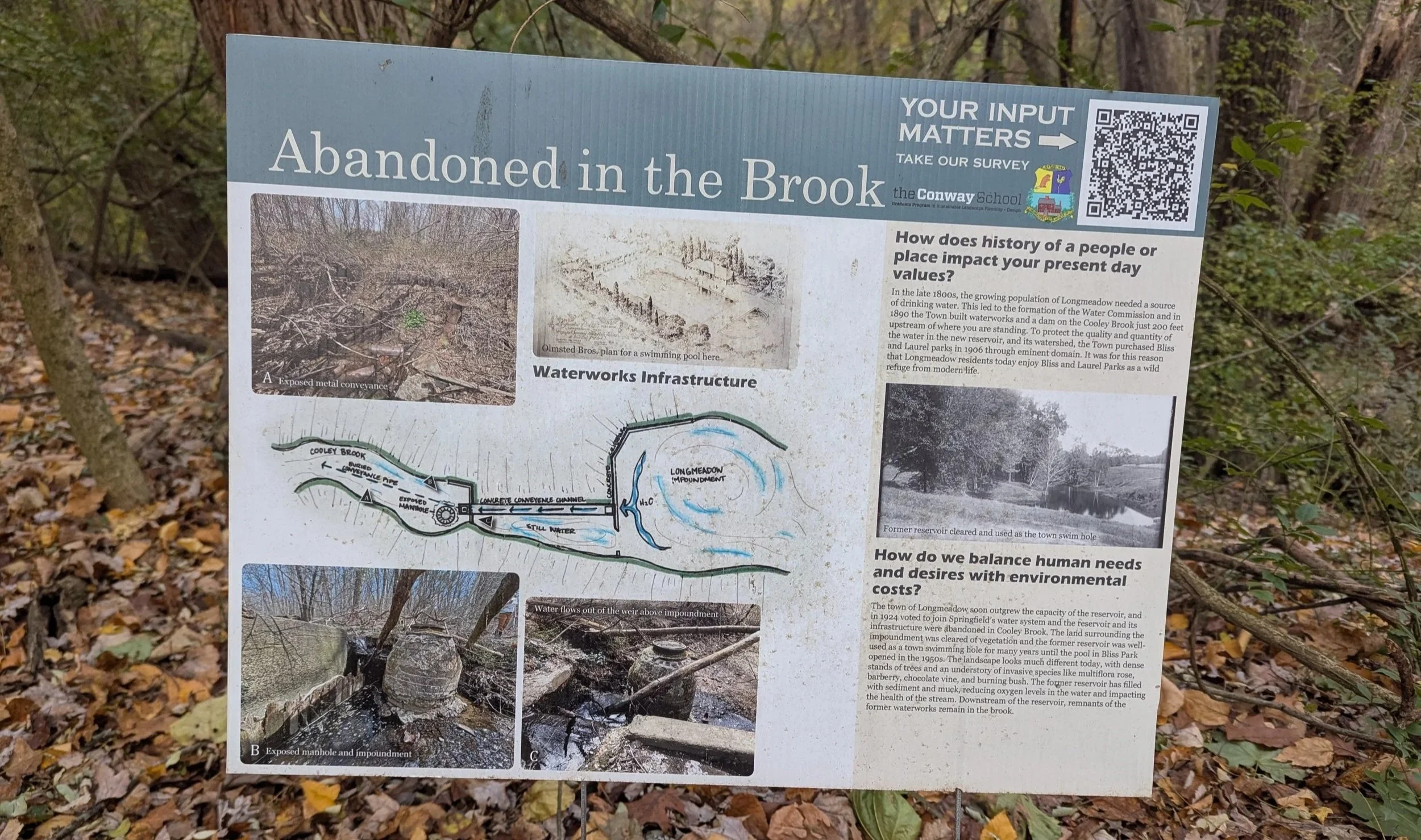
Conway School sign along one trail in Laurel Park (Photo taken in 2025)
The plan for Cooley Brook is just one example of landscape architectural work the Olmsted family has done in the area. For instance, Frederick Law Olmsted influenced the design of Forest Park in Springfield, MA. Later, Olmsted's sons developed a plan for the Colony Hills neighborhood, which is a short distance from Laurel Park.
At the western edge of Laurel Park, a brick pillar includes a plaque that appears to confirm some of this information and includes a line that reads "Park plans designed by Frederick Law Olmsted".
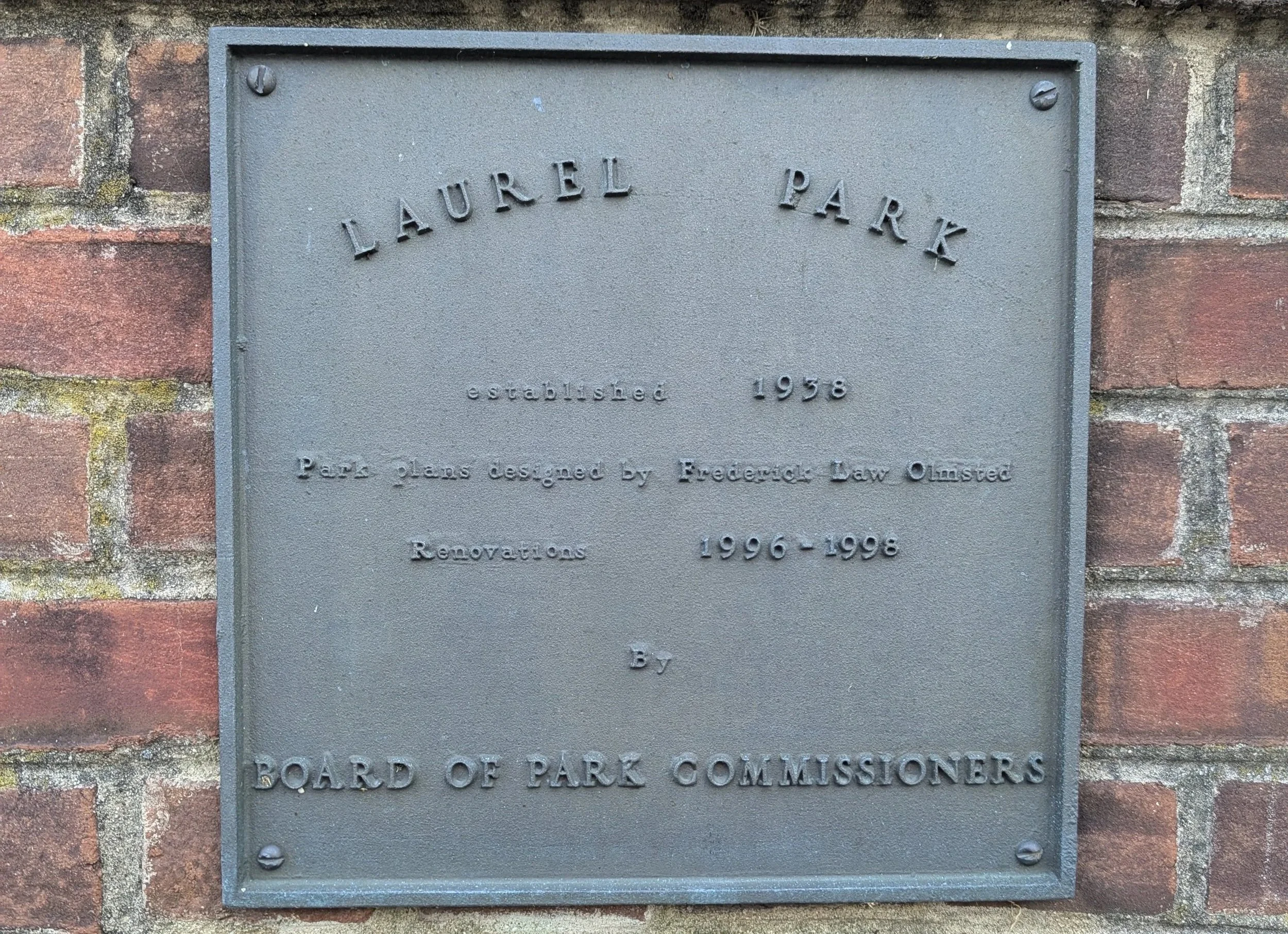
Laurel Park plaque (Photo taken in 2025)
Beyond the previously described brook, reservoir, and trails, Laurel Park mainly consists of an informal dirt parking lot, a few grass areas, and a considerable amount of forest. The forest includes some invasive species, most notably burning bush and black locust trees. The park also showcases many native New England plants, including oaks, birches, white pine, spice bush, maple leaf viburnum, and more.
Send Me a Message
Use the form below to send me a message if you'd like to work with me or learn more about my experience.